← 2026-10-16 edition · Sourced reporting
Published Oct 16, 2026, 10:00 AM Central · This version Oct 16, 2026, 10:00 AM Central · As of 2026-10-16
Capitol Reef lists Capitol Gorge closed and remote roads likely impassable
NPS’s October 15 update lists Capitol Gorge closed and many Waterpocket and Cathedral Valley routes as unknown, likely impassable. Some central roads are listed for 2WD. Check the park’s current conditions and recorded road line before choosing a route; a dated web table is not a guarantee. [1] [2] [3] [4]
Check NPS’s dated road tables and published phone route before departure: 435-425-3791, then 1 and 4 for road conditions. Online updates are weekly; no road or orchard access is guaranteed by yesterday’s notice. →Capitol Reef National Park, Utah; National Park Service conditions dated October 15, checked October 16. Road status and orchard notices have different scope. Conditions can change; unknown/likely impassable is not the same as verified closed or open.
- 1 source record
- National Park Service
Still open: No on-site observation, phone call or live route verification was conducted. NPS warns conditions can change rapidly. All open questions ↓
Reporting question · As of 2026-10-16
The question: What should a traveler check after Capitol Reef’s October 15 conditions update?
Capitol Reef National Park, Utah; National Park Service conditions dated October 15, checked October 16. Road status and orchard notices have different scope. Conditions can change; unknown/likely impassable is not the same as verified closed or open.
Listed for 2WD
Scenic Drive and Grand Wash in the October 15 table; route-specific, subject to change.
[1]Check the current record
NPS says its phone road-information line is more current than weekly web updates.
[3]Capitol Reef road-status table dated October 15, 2026. Cards are different status categories, not a sequence, measured risk scale or proof every segment has been inspected. Orchard notices are separate and date-specific.
Read the process as a table
| Component | Meaning | Evidence |
|---|---|---|
| Listed for 2WD | Scenic Drive and Grand Wash in the October 15 table; route-specific, subject to change. | [1] |
| Listed closed | Capitol Gorge in the October 15 table. | [1] |
| Unknown, likely impassable | Named remote-road rows retain both the warning and the uncertainty. | [2] |
| Check the current record | NPS says its phone road-information line is more current than weekly web updates. | [3] |
Archive photograph · 2014-08-07 · Capitol Reef National Park, Utah
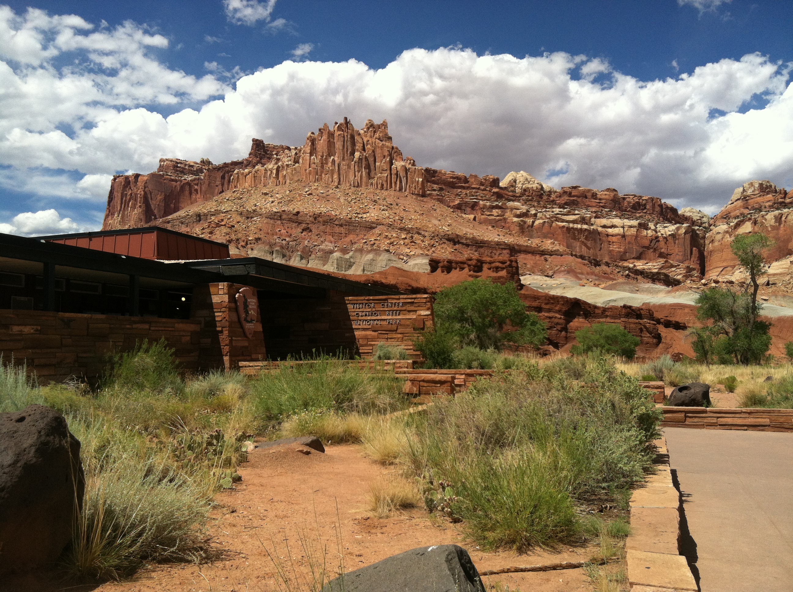

Understand the story.
One park, different routes
Scenic Drive and Grand Wash are listed as 2WD in the October 15 table. Capitol Gorge is closed, while Sulphur Creek is muddy and not recommended. Read the row for the route you intend to use. [1]
Unknown is a material warning
Notom-Bullfrog, Burr Trail, River Ford and Hartnet Road are among the routes listed as unknown, likely impassable. Preserve both words: the park is warning of likely poor access while disclosing that conditions are not fully known. [2]
Recheck before leaving
NPS says the recorded phone line is more current than its weekly web road updates. Use 435-425-3791, then 1 and 4, for the published road-information route. We have not called the line or verified a particular route on site. [3]
Do not carry yesterday’s orchard notice into today
The separate October 15 update names mud at Jackson orchard and an irrigation pause at Chesnut. Its daily wording does not establish October 16 opening status. Recheck the orchard information separately from road access. [4]
How we know4 scoped claims · 1 source recordView evidence
Each claim keeps its full assertion, date, source passage and limits. Source counts describe records, not independent corroboration.
1.The central roads differSupported
NPS’s October 15 table lists Scenic Drive and Grand Wash as 2WD, Capitol Gorge as Closed and Sulphur Creek as muddy, not recommended.
- Scope
- Capitol Reef National Park, Utah; National Park Service conditions dated October 15, checked October 16. Road status and orchard notices have different scope. Conditions can change; unknown/likely impassable is not the same as verified closed or open.
- Evidence passage
- Current Road Conditions → Fruita Historic District table, rows dated 10/15/26.
- As of
- 2026-10-16
- Limit
- A dated manager report, not an assurance of conditions at departure. A 2WD listing applies to the named road, not every route in the park.
Retrieved 2026-10-16T14:01:51.489Z · National Park Service
Responsible land manager’s dated conditions table, not our on-site inspection. NPS says web road updates are weekly and its recorded phone line is more current; status may change rapidly.
2.Remote roads are not verified openSupported
The Waterpocket and Cathedral Valley tables list multiple roads as Unknown, likely impassable, including Notom-Bullfrog, Burr Trail, River Ford and Hartnet Road.
- Scope
- Capitol Reef National Park, Utah; National Park Service conditions dated October 15, checked October 16. Road status and orchard notices have different scope. Conditions can change; unknown/likely impassable is not the same as verified closed or open.
- Evidence passage
- Current Road Conditions → Waterpocket District and Cathedral Valley District tables, 10/15/26 rows.
- As of
- 2026-10-16
- Limit
- Unknown/likely impassable is the source’s category, not an observed closure or proof a vehicle can pass. Do not generalize a listing to every segment beyond the source’s scope.
Retrieved 2026-10-16T14:01:51.489Z · National Park Service
Responsible land manager’s dated conditions table, not our on-site inspection. NPS says web road updates are weekly and its recorded phone line is more current; status may change rapidly.
3.Get the more current checkSupported
NPS says road information online is updated weekly and its phone line has the most up-to-date information. It gives 435-425-3791, then 1 for information and 4 for road conditions.
- Scope
- Capitol Reef National Park, Utah; National Park Service conditions dated October 15, checked October 16. Road status and orchard notices have different scope. Conditions can change; unknown/likely impassable is not the same as verified closed or open.
- Evidence passage
- Current Road Conditions introductory paragraph and recorded phone-tree instructions.
- As of
- 2026-10-16
- Limit
- We verified the published destination, not today’s audio recording; no call was made. Weather can change conditions after any update.
Retrieved 2026-10-16T14:01:51.489Z · National Park Service
Responsible land manager’s dated conditions table, not our on-site inspection. NPS says web road updates are weekly and its recorded phone line is more current; status may change rapidly.
4.Orchard access has its own dateSupported
The October 15 orchard update says Jackson orchard is closed that day because of excessive mud, Chesnut harvest is paused for irrigation, and Krueger is open for apples from 9 a.m. to 5 p.m. Harvest timing can change.
- Scope
- Capitol Reef National Park, Utah; National Park Service conditions dated October 15, checked October 16. Road status and orchard notices have different scope. Conditions can change; unknown/likely impassable is not the same as verified closed or open.
- Evidence passage
- Orchard Updates → October 15, 2026 update, named orchard bullets and availability note.
- As of
- 2026-10-16
- Limit
- The word today refers to the October 15 notice; it does not verify October 16 orchard access. These are not road-table categories.
Retrieved 2026-10-16T14:01:51.489Z · National Park Service
Responsible land manager’s dated conditions table, not our on-site inspection. NPS says web road updates are weekly and its recorded phone line is more current; status may change rapidly.
What remains open.
- No on-site observation, phone call or live route verification was conducted. NPS warns conditions can change rapidly.
- The October 15 orchard notice does not verify October 16 openings; no promise of fruit or access is made.
- We have not established when each condition first changed. The news is the manager’s newly dated October 15 operational update, not a claim of a newly observed closure today.
A newer or corrected original that changes the central finding, scope, operational status or applicable dates requires a separately identified revision and renewed source review.
THIS STORY IN TIME
Keep the dates with the story.
- Reported development
- Evidence as of
- First retained publication
- This version published
Publication times are Central. A development date and an evidence date can differ. Missing dates remain unrecorded.