← 2026-10-17 edition · Sourced reporting
Published Oct 17, 2026, 4:20 PM Central · This version Oct 17, 2026, 4:20 PM Central · As of 2026-10-17
Capitol Reef now lists two remote roads for high-clearance 4WD
NPS now lists Notom-Bullfrog and Burr Trail as HC4WD, replacing the unknown, likely impassable account retained in our October 16 report. Other limits remain: Capitol Gorge is closed, and Cathedral Valley is HC4WD only to the Temples, with conditions beyond unknown. Check your exact route before leaving. [1] [2] [3] [4]
Check the exact NPS road row and date. The page gives the recorded road-information number and menu for a more current check. →Capitol Reef National Park, Utah; NPS road rows dated October 16–17, 2026, on the page last updated October 17. The introductory October 15 date is older than individual rows. Road categories are dated manager reports, not a physical inspection, guaranteed passage or whole-park clearance.
- 1 source record
- National Park Service
Still open: No field inspection, phone recording or current weather/road measurement obtained. A dated category can change after capture. All open questions ↓
Reporting question · As of 2026-10-17
The question: Which Capitol Reef road categories changed, and what still limits a trip?
Capitol Reef National Park, Utah; NPS road rows dated October 16–17, 2026, on the page last updated October 17. The introductory October 15 date is older than individual rows. Road categories are dated manager reports, not a physical inspection, guaranteed passage or whole-park clearance.
Notom-Bullfrog / Burr Trail
HC4WD · rows dated October 16. High-clearance four-wheel-drive category.
[1]Individual dated NPS route categories, not a safe route sequence, complete loop or present physical assurance. HC4WD does not describe the unknown segment beyond the Temples.
Read the process as a table
| Component | Meaning | Evidence |
|---|---|---|
| Notom-Bullfrog / Burr Trail | HC4WD · rows dated October 16. High-clearance four-wheel-drive category. | [1] |
| Cathedral Valley: to Temples | HC4WD to Temples · October 16. Beyond: unknown. | [2] |
| River Ford / Hartnet / Bentonite | Unknown · October 17. Source notes impassable on October 14. | [2] |
| Capitol Gorge | Closed · October 17. Other named-road categories do not clear it. | [3] |
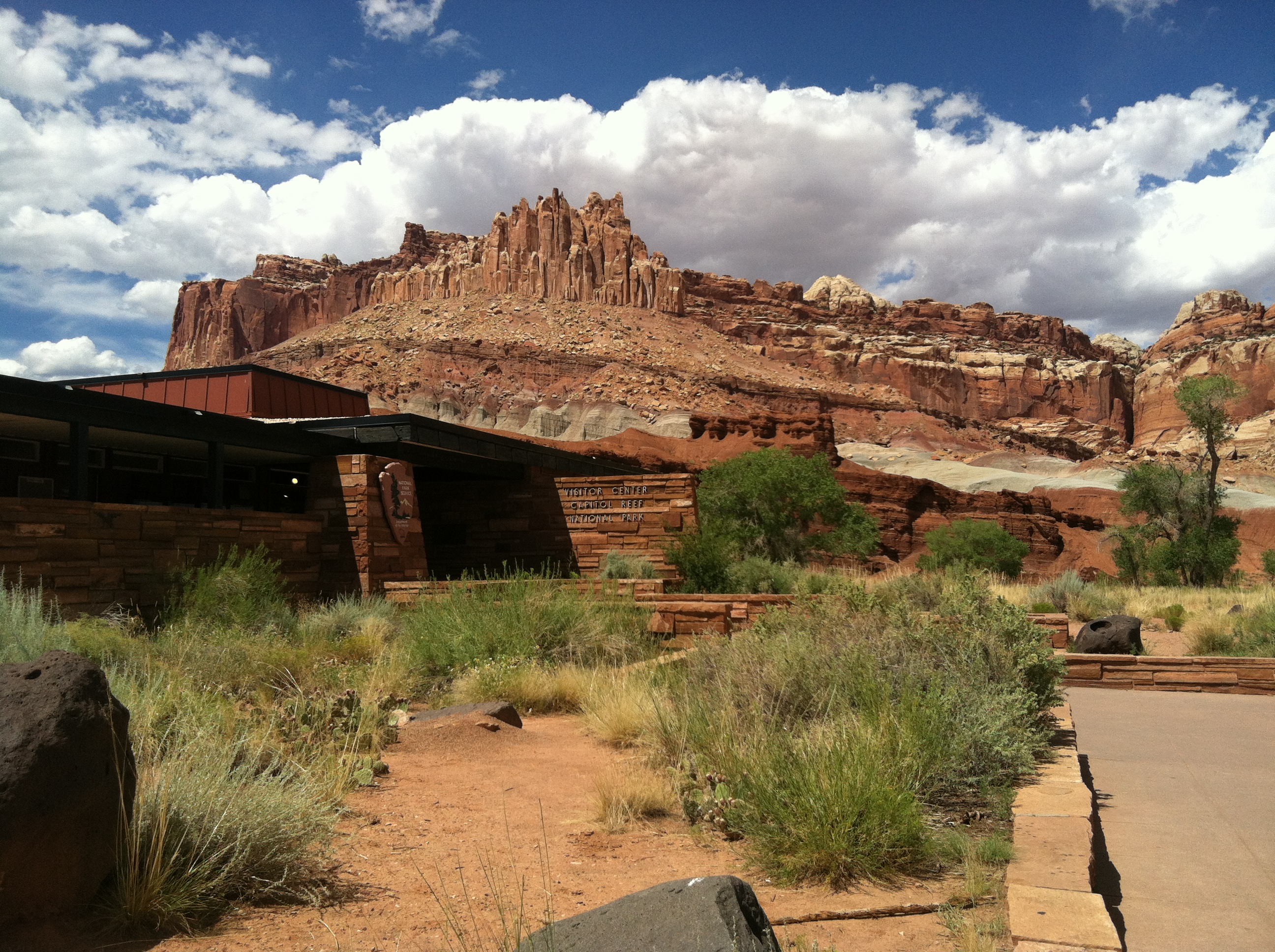
Archive photograph · 2014-08-07 · Capitol Reef National Park, Utah

Understand the story.
The vehicle category changed
The Notom-Bullfrog and Burr Trail rows now say HC4WD and carry October 16 dates. NPS defines that as high-clearance four-wheel drive. Its minimum clearance is eight inches, with vehicle length another possible constraint. [1] [4]
Keep the boundary beside the route
Cathedral Valley is listed HC4WD to the Temples, with conditions beyond unknown. River Ford, Hartnet Road and Bentonite Hills also remain unknown in October 17 rows. Those limits prevent a park-wide assurance of passage. [2]
One closure still matters
The October 17 central-road rows keep Capitol Gorge closed. Scenic Drive and Grand Wash have 2WD listings. Check the row for your destination rather than applying another road’s category to it. [3]
Check before setting out
The page’s introductory road date remains October 15; individual rows are newer. NPS says its recorded line is more current: 435-425-3791, then 1 and 4. We checked the published menu, without making a call or inspecting the roads. [1] [2] [3] [4]
How we know4 scoped claims · 1 source recordView evidence
Each claim keeps its full assertion, date, source passage and limits. Source counts describe records, not independent corroboration.
1.Two roads now carry an HC4WD categorySupported
NPS lists Notom-Bullfrog and Burr Trail as HC4WD, with both rows dated October 16. Its legend defines that category as High Clearance Four Wheel Drive.
- Scope
- Capitol Reef National Park, Utah; NPS road rows dated October 16–17, 2026, on the page last updated October 17. The introductory October 15 date is older than individual rows. Road categories are dated manager reports, not a physical inspection, guaranteed passage or whole-park clearance.
- Evidence passage
- Current Road Conditions → condition legend; Waterpocket District → Notom-Bullfrog and Burr Trail, 10/16/26 rows.
- As of
- 2026-10-17
- Limit
- Category change is compared with our retained earlier account. Exact physical improvement time and individual vehicle suitability are not established.
Retrieved 2026-10-17T20:02:16.918Z · National Park Service
Dated manager snapshot; mixed dates and route boundaries remain visible. No call, field inspection or guarantee of current passage.
2.The boundary at the Temples mattersSupported
The Cathedral Valley row dated October 16 says HC4WD to Temples, unknown beyond. October 17 rows list River Ford, Hartnet Road and Bentonite Hills as unknown, noting they were impassable October 14.
- Scope
- Capitol Reef National Park, Utah; NPS road rows dated October 16–17, 2026, on the page last updated October 17. The introductory October 15 date is older than individual rows. Road categories are dated manager reports, not a physical inspection, guaranteed passage or whole-park clearance.
- Evidence passage
- Current Road Conditions → Cathedral Valley District → Cathedral Valley, 10/16/26; River Ford, Hartnet Road and Bentonite Hills Area, 10/17/26.
- As of
- 2026-10-17
- Limit
- Unknown beyond the Temples is a material boundary. Earlier impassability does not establish present passage or a detour.
Retrieved 2026-10-17T20:02:16.918Z · National Park Service
Dated manager snapshot; mixed dates and route boundaries remain visible. No call, field inspection or guarantee of current passage.
3.A central closure continuesSupported
October 17 rows list Scenic Drive and Grand Wash as 2WD, and Capitol Gorge as Closed. These are individual route categories.
- Scope
- Capitol Reef National Park, Utah; NPS road rows dated October 16–17, 2026, on the page last updated October 17. The introductory October 15 date is older than individual rows. Road categories are dated manager reports, not a physical inspection, guaranteed passage or whole-park clearance.
- Evidence passage
- Current Road Conditions → Fruita Historic District → Scenic Drive, Grand Wash and Capitol Gorge, 10/17/26.
- As of
- 2026-10-17
- Limit
- A 2WD category on one named road does not reopen Capitol Gorge or other routes.
Retrieved 2026-10-17T20:02:16.918Z · National Park Service
Dated manager snapshot; mixed dates and route boundaries remain visible. No call, field inspection or guarantee of current passage.
4.Use the more current route checkSupported
NPS defines high clearance as at least eight inches and warns wheelbase can also matter. It says its recorded road line is more current than the webpage: 435-425-3791, then 1 and 4.
- Scope
- Capitol Reef National Park, Utah; NPS road rows dated October 16–17, 2026, on the page last updated October 17. The introductory October 15 date is older than individual rows. Road categories are dated manager reports, not a physical inspection, guaranteed passage or whole-park clearance.
- Evidence passage
- Current Road Conditions introduction and high-clearance definition; recorded phone-tree instructions → #1 then #4.
- As of
- 2026-10-17
- Limit
- The number and menu were read in the source; no call or current audio check was performed.
Retrieved 2026-10-17T20:02:16.918Z · National Park Service
Dated manager snapshot; mixed dates and route boundaries remain visible. No call, field inspection or guarantee of current passage.
What remains open.
- No field inspection, phone recording or current weather/road measurement obtained. A dated category can change after capture.
- The current page retains an October 15 introductory road date alongside October 16–17 rows. We use each row’s date; no precise reopening hour is established.
- The before comparison uses our retained October 16 public report and its recorded source hash, not the unavailable earlier raw source file.
- This story replaces Kenya in the current selection while that latest case-count lead lacks an accepted original capture; Kenya’s earlier dated report and permanent story remain retained.
A newer NPS row, closure order, corrected route boundary or verified route-specific condition would reopen this account and its map.
THIS STORY IN TIME
Keep the dates with the story.
- Reported development
- Evidence as of
- First retained publication
- This version published
Publication times are Central. A development date and an evidence date can differ. Missing dates remain unrecorded.