← 2026-10-30 edition · Sourced reporting
Yosemite announces snow closures; verify Tioga and Glacier Point roads before driving
As of 2026-10-30 · Publication details
Tioga Road: Closed[1] [4]
October 30 NPS table: Closed after the announced October 29, 6 p.m. temporary snow closure. Verify before travel.
Glacier Point Road: Closed[2] [4]
October 30 NPS table: Closed. The earlier Open label conflict is resolved; no reopening time is established.
Road line: verify now[3]
209/372-0200, press 1 then 1; NPS says this is the most current source.
October 30 NPS update to the October 29 temporary snow-closure notice. Both road labels now say Closed. Not a live map, safe-driving assurance or reopening forecast; use the recorded road line for current conditions.
Read the records as a table
| Record | Meaning |
|---|---|
| Tioga Road: Closed | October 30 NPS table: Closed after the announced October 29, 6 p.m. temporary snow closure. Verify before travel. [1] [4] |
| Glacier Point Road: Closed | October 30 NPS table: Closed. The earlier Open label conflict is resolved; no reopening time is established. [2] [4] |
| Road line: verify now | 209/372-0200, press 1 then 1; NPS says this is the most current source. [3] |
Yosemite National Park, California: October 29 closure notice and October 30 NPS update, both captured October 30. The updated table marks Tioga and Glacier Point roads Closed, resolving the earlier Glacier Point label conflict. No live road observation, reopening time or blanket park closure established.
NPS’s October 30 conditions page marks Tioga and Glacier Point roads Closed after the announced October 29 snow closures. This resolves the earlier Glacier Point Open label conflict. Check the park’s recorded road line before driving; no reopening time is established here. [1] [2] [3] [4]
Still open: The earlier Glacier Point label conflict is resolved in the October 30 NPS table; no independent on-ground observation or verified reopening time is available. All open questions ↓
Check Yosemite’s dated conditions page and call its recorded road line, 209/372-0200 (press 1 then 1), for the most current conditions before driving. No reopening time is verified here. →Read the full story
The reporting question: Can you rely on Yosemite’s road-status labels for today’s drive?
What the park announced
NPS announced temporary closures at 6 p.m. October 29 on Tioga and Glacier Point roads for forecast snow. The October 30 page retains that notice and the overnight-parking ban along both roads and their lots. This is a temporary road notice, not evidence that every park entrance is closed. [1] [3] [4]
The updated labels now agree
The earlier capture paired Glacier Point’s closure wording with an Open label. The page last updated October 30 now marks both Tioga and Glacier Point Closed, resolving that table conflict. We have not observed conditions on the ground or called the recorded road line; the update does not establish a reopening time. [2] [4]
Check your actual approach
Use 209/372-0200, press 1 then 1, immediately before travel. The page separately lists Wawona, El Portal and Big Oak Flat roads as open, but says its table is not the most current road information. We have no verified reopening time for the two announced snow closures. [3]
Archive photograph · 2012-06-13 · Tioga Road near Lee Vining, California, United States
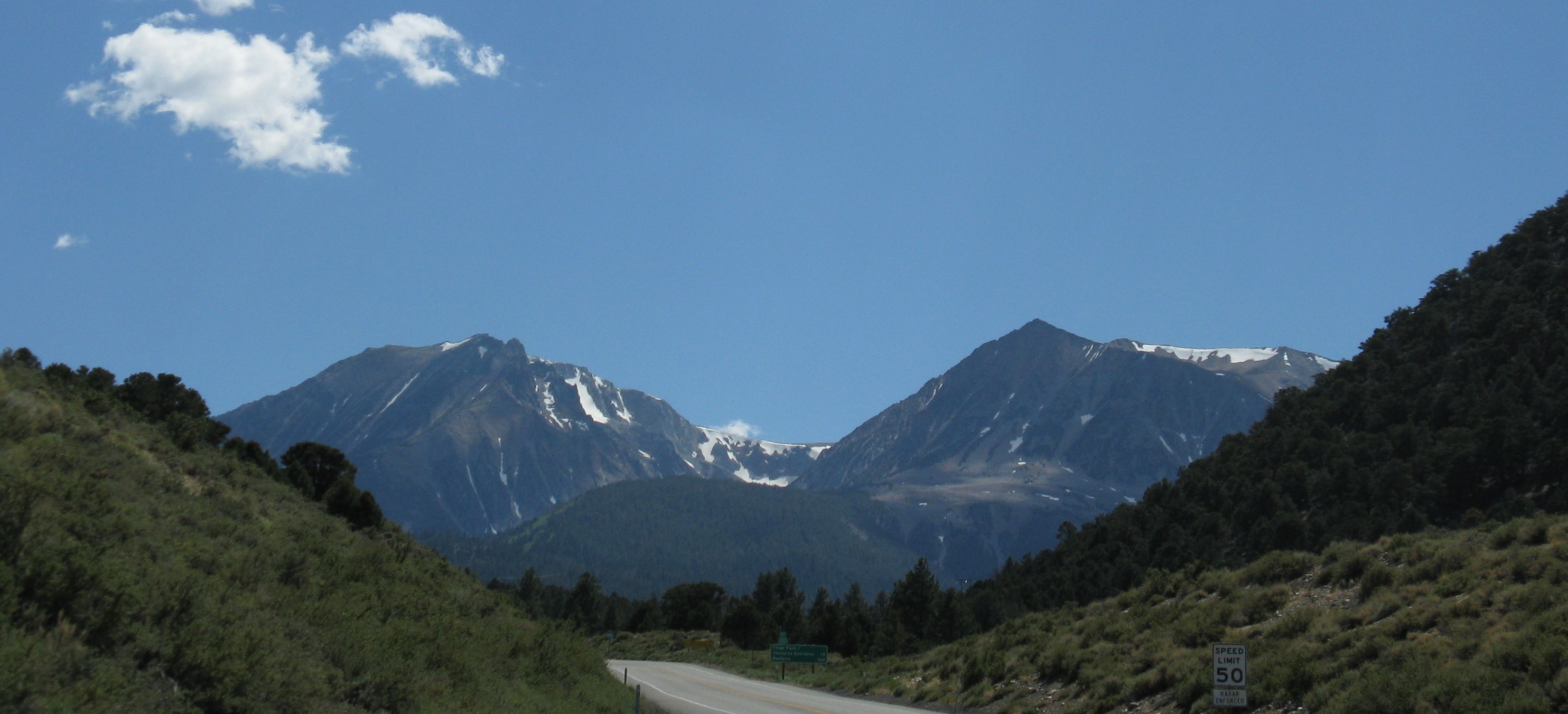

- 2 source records
- National Park Service / Yosemite National Park
How we know4 scoped claims · 2 source recordsView evidence
Each claim keeps its full assertion, date, source passage and limits. Source counts describe records, not independent corroboration.
1.Closure announcementSupported
The October 29 conditions page announces temporary closure of Tioga Road and Glacier Point Road at 6 p.m. that day because of forecast snow, with no overnight parking along either road or its lots.
- Scope
- Yosemite National Park, California: October 29 closure notice and October 30 NPS update, both captured October 30. The updated table marks Tioga and Glacier Point roads Closed, resolving the earlier Glacier Point label conflict. No live road observation, reopening time or blanket park closure established.
- Evidence passage
- Road Status, Tioga Road and Glacier Point Road rows; Last updated October 29, 2026.
- As of
- 2026-10-30
- Limit
- Dated official notice, not independently observed road access. The October 30 update resolves the earlier label conflict; live conditions and reopening time remain unverified.
Retrieved 2026-10-30T12:37:35.555Z · National Park Service / Yosemite National Park
Historical capture: Glacier Point’s Open label conflicted with its announced closure. The separately retained October 30 update resolves the label conflict; neither capture establishes live on-ground conditions or a reopening time.
2.Historical status conflictSupported
The earlier capture, of the page last updated October 29, marked Tioga Closed but paired Glacier Point’s closure announcement with an Open label.
- Scope
- Yosemite National Park, California: October 29 closure notice and October 30 NPS update, both captured October 30. The updated table marks Tioga and Glacier Point roads Closed, resolving the earlier Glacier Point label conflict. No live road observation, reopening time or blanket park closure established.
- Evidence passage
- Road Status, separate status cells for Tioga Road and Glacier Point Road.
- As of
- 2026-10-30
- Limit
- Dated official notice, not independently observed road access. The October 30 update resolves the earlier label conflict; live conditions and reopening time remain unverified.
Retrieved 2026-10-30T12:37:35.555Z · National Park Service / Yosemite National Park
Historical capture: Glacier Point’s Open label conflicted with its announced closure. The separately retained October 30 update resolves the label conflict; neither capture establishes live on-ground conditions or a reopening time.
3.Current check and separate approachesSupported
The page directs readers to 209/372-0200, press 1 then 1, for the most current conditions and warns the table reflects planned or long-term closures. It separately lists Wawona, El Portal and Big Oak Flat roads as open.
- Scope
- Yosemite National Park, California: October 29 closure notice and October 30 NPS update, both captured October 30. The updated table marks Tioga and Glacier Point roads Closed, resolving the earlier Glacier Point label conflict. No live road observation, reopening time or blanket park closure established.
- Evidence passage
- Road Status introduction and Wawona, El Portal, Big Oak Flat rows in the retained October 29 version and October 30 update.
- As of
- 2026-10-30
- Limit
- Dated official notice, not independently observed road access. The October 30 update resolves the earlier label conflict; live conditions and reopening time remain unverified.
Retrieved 2026-10-30T12:37:35.555Z · National Park Service / Yosemite National Park
Historical capture: Glacier Point’s Open label conflicted with its announced closure. The separately retained October 30 update resolves the label conflict; neither capture establishes live on-ground conditions or a reopening time.
Retrieved 2026-10-30T19:17:37.396Z · National Park Service / Yosemite National Park
Official status table, not independent on-ground observation. NPS says it reflects planned or long-term closures; use the recorded road line for the most current conditions. No reopening time established.
4.October 30 status updateSupported
The NPS conditions page last updated October 30 marks both Tioga Road and Glacier Point Road Closed, resolving the earlier Glacier Point Open label conflict. Both rows retain the October 29, 6 p.m. temporary snow-closure announcement and overnight-parking restriction.
- Scope
- Yosemite National Park, California: October 29 closure notice and October 30 NPS update, both captured October 30. The updated table marks Tioga and Glacier Point roads Closed, resolving the earlier Glacier Point label conflict. No live road observation, reopening time or blanket park closure established.
- Evidence passage
- Road Status: Tioga Road and Glacier Point Road status cells both say Closed; Last updated October 30, 2026.
- As of
- 2026-10-30
- Limit
- This establishes the updated official table, not independent observation, a safe-driving assurance or a reopening time.
Retrieved 2026-10-30T19:17:37.396Z · National Park Service / Yosemite National Park
Official status table, not independent on-ground observation. NPS says it reflects planned or long-term closures; use the recorded road line for the most current conditions. No reopening time established.
What remains open.
- The earlier Glacier Point label conflict is resolved in the October 30 NPS table; no independent on-ground observation or verified reopening time is available.
- No live observation or telephone check performed; weather and access may change after capture.
Reopen this exact draft for a correction, new original record resolving the named gaps, changed scope/date, or changed source/photo bytes. Preserve the earlier version.
THIS STORY IN TIME
Keep the dates with the story.
- Reported development
- Evidence as of
- First retained publication
- This version published
Publication times are Central. A development date and an evidence date can differ. Missing dates remain unrecorded.
What readers add.
Comments are reviewed before they appear. Max includes five comments and two custom story requests each day.
Loading reviewed comments…
Add a comment with Max →